
Coastal Living
Flood Insurance on the North Shore: The 2026 Guide to Coastal Risk, Cost, and Home Values
Kathleen Militello · Published October 7, 2026 · Updated October 7, 2026 · 12 min read
Coastal Living
Kathleen Militello · Published October 7, 2026 · Updated October 7, 2026 · 12 min read
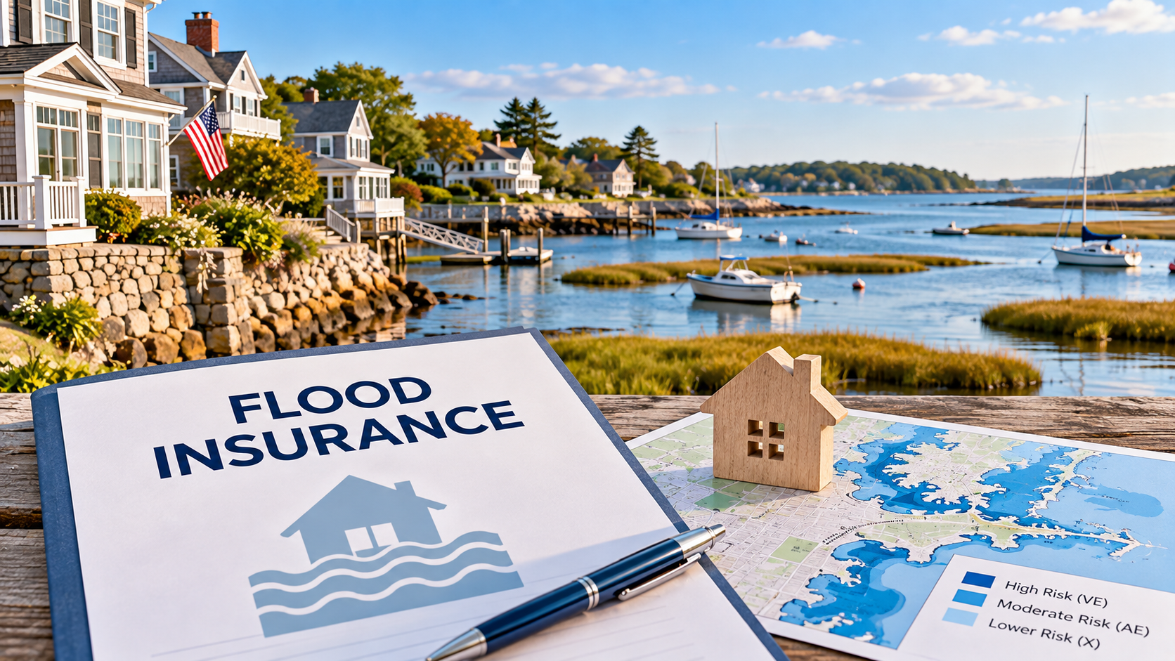
Every coastal home on the North Shore has two addresses: the street address, and the flood zone on the FEMA map. One of them you see on every piece of mail; the other quietly shapes insurance, financing, and resale. This guide is the practical version of that second address: how flood zones work here, what flood insurance actually costs in 2026, what to check before you make an offer, and how flood risk fits into home value.
Key Takeaways
In FEMA Special Flood Hazard Areas, a federally backed mortgage requires flood insurance, and on the North Shore those zones touch Newburyport, Essex, Rowley, Newbury, Salisbury, Gloucester, Rockport, Manchester-by-the-Sea, and the towns around them.
A zone with a 1 percent annual chance of flooding carries a greater than 1 in 4 chance of flooding at least once over a 30-year mortgage, which is why lenders take it seriously.
FEMA's Risk Rating 2.0 prices premiums per property using elevation, distance to water, flood history, and replacement cost, so the only real number is a quote for the exact home, not a rule of thumb.
National average NFIP premiums run roughly $925 to $975 per year, Massachusetts coastal properties commonly range from about $1,100 to $2,100 or more, and annual increases are capped at 18 percent under the new pricing.
Flood risk refines coastal value rather than destroying it: homes with elevation certificates, documented mitigation, and a known insurance cost sell more easily because the risk is understood and budgeted.
The second address
For much of the coast, flood insurance is not an optional extra; it is a requirement. If a home sits in a FEMA Special Flood Hazard Area, a federally backed mortgage lender will require flood insurance before the loan funds. That situation is not rare on the North Shore: Newburyport hugs the Merrimack, Essex and Rowley sit beside tidal marshes and river estuaries, Newbury and Salisbury run along the barrier coast, and Gloucester, Rockport, and Manchester-by-the-Sea have shoreline and inlets that place portions of town in mapped zones.
The classic way to explain the risk: a zone with a 1 percent annual chance of flooding is often called a 100-year floodplain, but over a 30-year mortgage the odds of that flood happening at least once are greater than 1 in 4. That is why lenders and the National Flood Insurance Program take these zones seriously, and why flood insurance belongs in your budget before you fall in love with a view.
A, AE, and the V at the edge
FEMA maps divide the coast into zones, and three letters cover most North Shore situations. Zone A is the approximate high-risk zone: a 1 percent annual chance of flooding, but without a published base flood elevation. Zone AE is the detailed version of the same risk, with a published base flood elevation, the number builders and insurers use. Both A and AE are Special Flood Hazard Areas, and both trigger the insurance requirement for federally backed loans.
At the very edge, where waves carry real energy, the maps add V zones, the highest coastal hazard, plus a related category, the Coastal A zone, where wave action can reach a few feet and the maps set a limit of moderate wave action. The practical difference for a homeowner: the higher the expected water and wave action, the more the building must be designed and elevated to withstand it, and that work is spelled out in the Massachusetts building code for coastal zones.
You do not need to become a floodplain expert. You do need to know three things about any coastal home: the zone on the current FEMA map, the base flood elevation, and where the house sits relative to it. Those three facts drive the insurance quote more than anything else.
Risk Rating 2.0 changed the math
FEMA's pricing method changed in 2021 and 2022 with what it calls Risk Rating 2.0. Under the old system, the zone letter largely set the price. Under the new one, the premium is property-specific: it looks at distance to water, flood type and frequency, the elevation of the lowest floor relative to the base flood elevation, prior claims, and replacement cost. Two similar homes two streets apart can carry very different premiums, and the only way to know yours is a quote rather than a guess.
For context, the national average NFIP policy runs roughly $925 to $975 a year in 2025 and 2026, and typical new policies land between about $250 and $1,500, with coastal high-hazard properties often well above that and coastal V-zone policies averaging close to $2,000. Massachusetts averages reported over the last year or two sit somewhere between about $1,100 and $2,100 depending on the property, which tells you how wide the range really is.
One safeguard is worth knowing: FEMA caps annual rate increases at 18 percent until a policy reaches its full risk-based rate, so premiums step up gradually rather than jumping overnight. Private flood insurers also write policies on the North Shore and can sometimes price below NFIP, so a good insurance agent shops the options, not just the paperwork.
Five minutes of homework
Pull the current FEMA flood map for the property and note the zone: A, AE, V, or outside the mapped floodplain.
Ask for an elevation certificate; if one was never done, budget for a surveyor to prepare one, because your premium depends on finished floor elevation.
Get a real flood insurance quote before you write the offer, and include it in your monthly carrying cost, not as an afterthought.
Ask about the property's flood claims history and its mitigation features: flood vents, raised utilities, and foundation details all change the risk.
Check how the town participates in the National Flood Insurance Program, since community ratings can earn premium discounts.
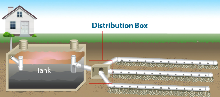
If the home has a septic system, confirm the <a href='/insights/septic-systems-massachusetts-buyers-guide/' class='font-medium text-glow underline decoration-glow/40 underline-offset-4 transition hover:text-ink'>Title 5</a> status early, because water access and flood zones interact in coastal towns.
My waterfront buyer's guide covers the rest of the coastal checklist, from bulkheads to boat access.
Priced in, not a dealbreaker
Here is the honest economics. Flood risk is a real factor in coastal pricing, but it rarely removes the coastal premium; it refines it. A view, direct water access, and a walk to the beach carry real value on the North Shore, and buyers who understand flood risk, insurance, and elevation pay for that value because they know what they are buying.
Resale works the same way. The buyers most willing to pay for coastal living are the ones who understand the risk, which means accurate, current information actually protects value. A home with a clean elevation certificate, documented mitigation, and a known insurance cost is easier to sell than a home where the buyer has to discover those answers for themselves.
In other words, the risk is not something to hide from or fear; it is something to know, price, and budget. That is the entire job, and it is very doable.
Mitigation lowers the premium
Flood insurance is not a fixed tax. Because Risk Rating 2.0 prices the property, improvements that reduce risk also reduce the premium. Elevating the lowest floor or the mechanical systems, installing flood openings and vents, and correcting foundation details all move the quote, and FEMA and Massachusetts programs have helped coastal homeowners fund exactly these kinds of mitigation projects.
Homeowners should also shop the market. NFIP is the baseline, but private flood insurers compete on the North Shore, and the right insurance agent will quote both. Community-level participation in NFIP programs can earn discounts too, so it is worth asking what your town already does.
And for anyone buying or holding a coastal home, keep the file current: monitor the maps when FEMA updates them, keep any elevation certificate safe, and review the policy at renewal. It is paperwork that pays for itself.
Budget, verify, and enjoy the coast
None of this should talk you out of coastal living; it should talk you into knowing what you are buying. A North Shore waterfront home is one of the most beautiful places to live in Massachusetts, and thousands of homeowners carry flood insurance every year without drama. The difference between anxiety and confidence is a map, a quote, and a little homework, all of which are easier to get than people expect.
If you are looking at coastal homes, ask me the flood questions before you make the offer, and I will give you straight answers, because I want you to understand exactly what you are getting into. That is the whole point.
The next step is easy. When we talk about a coastal home, we put flood zone, elevation, and insurance cost on the table in the first conversation, so the price you consider is the price you can actually carry. Call or text me at (978) 500-1480 or book a conversation, and let's look at your options. Warmly, Kathleen Militello, Realtor®, eXp Realty.
Ask Kathleen
Straight answers about cost, zones, and coastal home values.
If the home is outside a mapped Special Flood Hazard Area, a federally backed lender will not require it, though many coastal homeowners still choose an optional policy because heavy rain and drainage events happen. Your insurance agent can quote both and let you decide.
It is property-specific now. National averages run roughly $925 to $975 a year, Massachusetts coastal properties commonly range from about $1,100 to $2,100 or more, and very exposed homes can cost more. The only number that matters is the quote for the exact property, so get one before your offer.
Premiums are now priced per property instead of by zone letter alone. Distance to water, flood history, lowest-floor elevation, prior claims, and replacement cost all factor in, so two similar homes can have very different premiums. Annual increases are capped at 18 percent until a policy reaches its full risk-based rate.
Flood risk refines pricing rather than destroying it; coastal value is still real. Homes with elevation certificates, documented mitigation, and a known insurance cost sell more easily, because the risk is understood and budgeted rather than mysterious.
For most buyers, no. The premium is knowable before you commit, and the coastal lifestyle is worth real money to people who understand it. The goal is to budget the cost and verify the details, not to rule out an entire category of beautiful homes.
The same questions and answers, un-styled and sequential, so they can be read and extracted easily.
Q: Do I need flood insurance if the home is not in a flood zone?
A: If the home is outside a mapped Special Flood Hazard Area, a federally backed lender will not require it, though many coastal homeowners still choose an optional policy because heavy rain and drainage events happen. Your insurance agent can quote both and let you decide.
Q: How much does flood insurance cost on the North Shore in 2026?
A: It is property-specific now. National averages run roughly $925 to $975 a year, Massachusetts coastal properties commonly range from about $1,100 to $2,100 or more, and very exposed homes can cost more. The only number that matters is the quote for the exact property, so get one before your offer.
Q: What changed with FEMA's Risk Rating 2.0?
A: Premiums are now priced per property instead of by zone letter alone. Distance to water, flood history, lowest-floor elevation, prior claims, and replacement cost all factor in, so two similar homes can have very different premiums. Annual increases are capped at 18 percent until a policy reaches its full risk-based rate.
Q: Does living in a flood zone hurt resale value?
A: Flood risk refines pricing rather than destroying it; coastal value is still real. Homes with elevation certificates, documented mitigation, and a known insurance cost sell more easily, because the risk is understood and budgeted rather than mysterious.
Q: Should I avoid coastal homes because of flood insurance?
A: For most buyers, no. The premium is knowable before you commit, and the coastal lifestyle is worth real money to people who understand it. The goal is to budget the cost and verify the details, not to rule out an entire category of beautiful homes.
Independent sites worth a look for general market and school information.

Written by
Kathleen Militello, Realtor®
The Militello Team · AI Certified Agent™ · Certified Negotiation Specialist™ · eXp Realty
Keep your reading going
Kathleen has helped North Shore buyers and sellers navigate flood zones, elevation certificates, and insurance costs for more than two decades. Bring the address, and we will bring the map.
Flood information changes as FEMA updates its maps and pricing, and every property is different. This guide is general information, not an insurance quote or legal advice, so verify the zone, premium, and policy details for your specific home before relying on them.
Related Posts
 Buying Your Next Home Buying a Waterfront Home on the North Shore: What Experienced Buyers Know That First-Timers Don't
  North Shore History Plum Island: The Barrier Beach That Shaped the North Shore Coast
  Buying Your Next Home What You Should Know Before Buying a Home with a Septic System in Massachusetts
  Luxury Coastal Living Coastal Luxury on the North Shore: What Buyers Should Know
  Things to Do North Shore Beaches: A Local's Guide to the Best Sand and Swimming
 From the page to the porch
A note can only tell you so much. Let Kathleen take you through the towns, the streets, and the options that actually fit.